数字式全景钻孔摄像系统
Copyright since 1998 Whrsm , All Rights Reserved 鄂ICP备 11007814号 鄂公网安备 42010602001930号
Research in various geotechnical engineering, structural studies are important component of surface, it is
because a key component of deformation and failure are located, such as cracks, joints, bedding plane faults and
other discontinuities, and structure of surface is usually represented by its geometric features, so the geometric
structure of surface support levy collection techniques, methods and means of scientific, advanced, completeness,
accuracy is particularly important.
Currently, the drill core measuring method is still widely used in underground or surface of the deep structure
determination of geometric method of holding signs. Although it is simple, convenient, practical, but for weak or
broken rock, drill core rate relatively low, accurately determine the structure of surface geometry is more difficult.
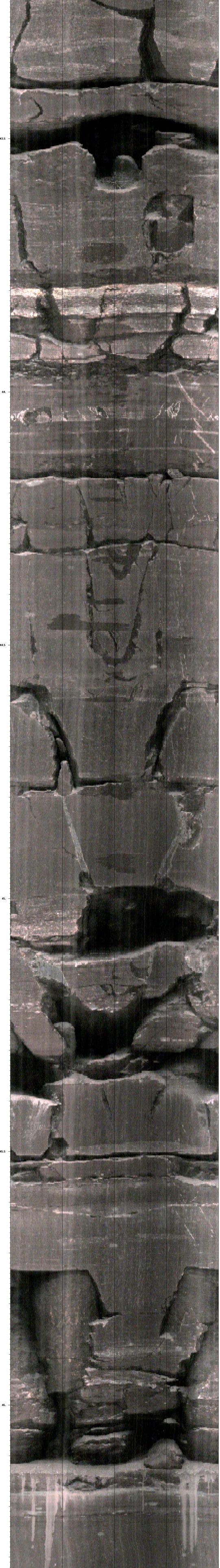
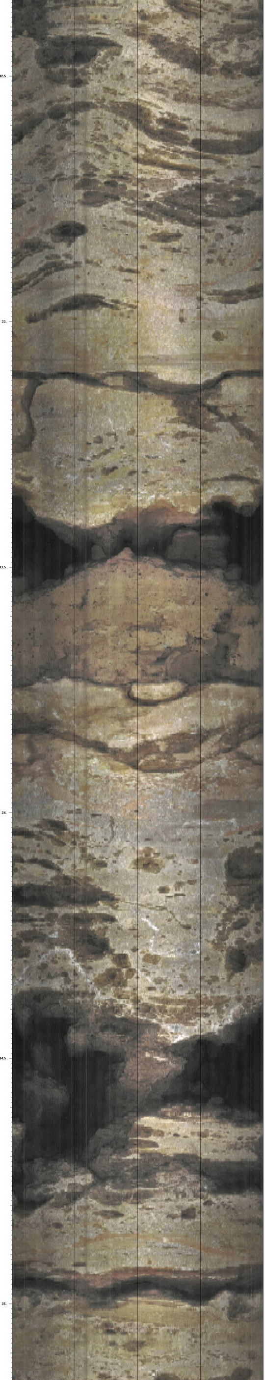
Since undisturbed geological drilling holes in the wall to maintain a complete geological features, so drilling
holes into the hole in the wall of detection, so that the project geologists complete and accurate access to geolog
ical data within the drilling equipment is digital panoramic borehole camera system.
Borehole camera technology has been widely used in petroleum industry, engineering geology, geotechnical
engineering, glaciers, mining engineering, and civil engineering. In most practical applications, the technology of
drilling holes through the wall of the observation site to make up for exploration and investigation of other deficie
ncies. It can be used to:
1) identification, estimation and measurement of geological features;
2) the differentiation of rock;
3) assess the porosity;
4) detectors, water flow, the entrance and accumulation of scale;
5) salvage operations and perforation secondary control;
6) advanced exploration, and so on.
Geotechnical Engineering: Geotechnical Engineering in the drilling and oil industry compared to light, but the
measurement accuracy and higher requirements. In the oil industry with little regard for the small cracks is import
ant in geotechnical engineering data; they may control the rock mass strength and stability. Borehole camera tech
nology in geotechnical engineering a wide range of applications, such as geological exploration, quality inspection,
safety monitoring, project evaluation results so on.
Some successful applications include a geological survey in the hole, engineer, quality inspection of concrete
and so on. In short, through a number of large projects' application and practice in recent years, digital panoramic
borehole camera system has been applied to the detection quality of concrete pouring, hidden hanger exploration,
reservoir leakage detection, landslide investigation, groundwater resource exploration, grouting qualit y testing,
environmental testing and evaluation in areas , civil, environmental and other industries has been widely used.


Digital Panoramic Borehole Camera System Engineering Application
数字式全景钻孔摄像系统的工程应用